


How do sensors collaborate when using multi-sensor fusion technology to ensure drone flight safety?
How do sensors collaborate when using multi-sensor fusion technology to ensure drone flight safety?
As a product of modern science and technology, drones have been widely used in many fields such as agriculture, surveying and mapping, inspection, entertainment, logistics, and rescue, thanks to their unique advantages. However, the safety of drone flights has always been a focus of public concern. To ensure the safety of drone flights, the application of multi-sensor fusion technology is particularly important. This article will discuss the application of multi-sensor fusion technology in ensuring the safety of drone flights and analyze how various sensors work together to achieve safe flight.
I. Overview of multi-sensor fusion technology
Multi-sensor fusion technology is a technology that integrates data from different sensors to improve data accuracy, integrity, real-time, and reliability. Multi-sensor fusion technology can effectively improve the safety of drone flights and reduce the occurrence of flight accidents.
II. Application of multi-sensor fusion technology in drone flight safety
Flight attitude and position perception
Drones' flight attitude and position perception sensors mainly include Inertial Measurement Units (IMU) and Global Positioning Systems (GPS). IMU can perceive the acceleration, angular velocity, rotational angular velocity, and gravity acceleration of drones, while GPS can provide accurate position information. With the support of multi-sensor fusion technology, the data of IMU and GPS can be fused to improve the accuracy of drone attitude and position, and realize real-time monitoring of the flight status of drones.
Atmospheric environment perception
Atmospheric environment perception sensors mainly include pressure sensors, temperature sensors, humidity sensors, wind speed and direction sensors, and so on. These sensors can perceive meteorological parameters in the flight environment of drones, such as pressure, temperature, humidity, wind speed, and wind direction. Through multi-sensor fusion technology, these meteorological parameters can be integrated to improve the perception accuracy and reliability of the flight environment of drones, thereby ensuring the safety of drone flights.
Mission area perception
Mission area perception sensors mainly include LiDAR, infrared thermal imagers, visible light cameras, etc. These sensors can perceive the terrain, obstacles, and target objects in the UAV's mission area. Through multi-sensor fusion technology, the data from these sensors can be integrated and processed to improve the perception accuracy and reliability of the UAV's mission area, thereby ensuring the safety of the UAV mission.
UAV health status perception
UAV health status perception sensors mainly include vibration sensors, temperature sensors, pressure sensors, current sensors, etc. These sensors can perceive the health status of the UAV, such as vibration, temperature, pressure, and current. Through multi-sensor fusion technology, the data from these sensors can be integrated and processed to improve the perception accuracy and reliability of the UAV's health status, thereby ensuring the safety of UAV flight.
How do various sensors work together to achieve safe flight?
Data fusion and processing
The core of multi-sensor fusion technology lies in data fusion and processing. Through data fusion and processing, data from different sensors can be integrated and processed to improve data accuracy, integrity, real-timeity, and reliability. During the UAV flight process, the data from various sensors can be fused and processed in real time to achieve real-time monitoring of the UAV's flight status.
Mission planning and decision-making
Multi-sensor fusion technology can also be used in UAV mission planning and decision-making. Through multi-sensor fusion technology, data from different sensors can be integrated and processed to improve the perception accuracy and reliability of the UAV's mission environment. During the process of UAV mission planning and decision-making, the UAV's mission can be optimized and planned based on the integrated data, thereby improving the safety of the UAV mission.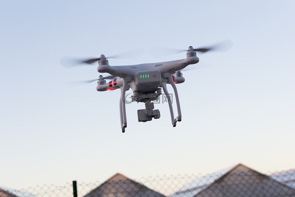
Flight control and navigation
Multi-sensor fusion technology can also be used in UAV flight control and navigation. Through multi-sensor fusion technology, data from different sensors can be integrated and processed to improve the perception accuracy and reliability of the UAV's flight environment. During the process of UAV flight control and navigation, precise control and navigation of the UAV's flight can be achieved based on the integrated data, thereby improving the safety of UAV flight.
In summary, the application of multi-sensor fusion technology in the safety of unmanned aerial vehicle (UAV) flight is of great significance. By the collaborative work of various sensors, it is possible to achieve real-time monitoring of the UAV's flight status, precise perception of the UAV's mission environment, and precise control and navigation of the UAV's flight, thereby improving the safety of UAV flight. In the future, with the continuous development of multi-sensor fusion technology, the safety of UAV flight will be further guaranteed.
 What are the teaching contents to cultivate emergency response capabilities in drone training?
 What are the key technical points of weapon carriage and firing for drones in military strike missions?
 How to adjust shooting parameters during drone shooting to obtain high-quality images?
 What are the industry standard requirements for operation specifications in the field of drone application?