


The principle of visual navigation technology for drones, through the way of image recognition to assist in flight?
Drone vision navigation technology is an important branch in the field of drone technology. It uses visual sensors such as cameras to achieve autonomous navigation and control of drones. Vision navigation technology utilizes artificial intelligence technologies such as image recognition and pattern recognition, enabling drones to autonomously plan flight paths based on environmental features, avoid obstacles, achieve precise positioning and high-precision navigation, thereby greatly enhancing the flexibility and adaptability of drones. The following will introduce the basic principles and application methods of drone vision navigation technology in detail.
1. Basic Principles
The core of drone vision navigation technology lies in using image recognition algorithms to enable drones to obtain real-time image information of the surrounding environment, and by analyzing these image information, identify the position, direction, and surrounding obstacles of the drone, etc. These information are used to adjust the flight attitude and path of the drone, thus realizing autonomous navigation and control.
2. Image Recognition Technologies
Image recognition is a key link in vision navigation technology, which analyzes images taken by drones through computer vision algorithms to identify key feature points or patterns in the images. Common image recognition technologies include but are not limited to:
Feature Point Matching: By identifying feature points (such as edges, corners, etc.) in images and performing matching, thus determining the position and direction of the drone.
Feature Matching: Using the texture, color, and other features of images for matching, thus identifying specific environmental features.
Deep Learning: By training deep neural networks, drones can recognize and understand complex environmental scenes.
3. Methods of Application
The application of drone vision navigation technology is extensive, covering many fields such as agriculture, surveying, logistics, and rescue: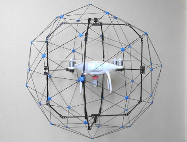
Agricultural Monitoring: Drones can use vision navigation technology to accurately identify the pest and disease situation in farmland, realizing precision agriculture.
Surveying and Terrain Measurement: Drones can conduct rapid terrain measurement in the air and accurately draw topographic maps through vision navigation technology.
Logistics Distribution: In logistics distribution, drones can use vision navigation technology to avoid complex terrain and obstacles and achieve accurate delivery of goods.
Rescue and Disaster Response: In emergency rescue or disaster response, drones can use vision navigation technology to quickly and accurately arrive at the scene of the accident and carry out rescue work.
4. Challenges and the Future
Although drone vision navigation technology has made significant progress, it still faces some challenges, such as the accuracy of image recognition in complex environments and the limitations of real-time processing capabilities. In the future, with the improvement of computational power and the continuous optimization of image recognition algorithms, drone vision navigation technology will become more mature, bringing more possibilities to all industries.
In summary, drone vision navigation technology is one of the important development directions in the drone field. It achieves autonomous navigation and control of drones through technologies such as image recognition and pattern recognition, greatly enhancing the flexibility and application scope of drones. With the continuous advancement of technology, the future of drone vision navigation technology will have a broader application prospect.
 What factors limit the communication distance of UAVs, and how can it be effectively extended?
 How to improve efficiency through innovative applications of drones in logistics and warehousing?
 What is the key role of the development of drone battery technology in enhancing endurance capability?
 The development of gesture control interaction functions for drones, the principle of recognizing gestures and executing them?